COLOURISATION FOR HOVERMAP
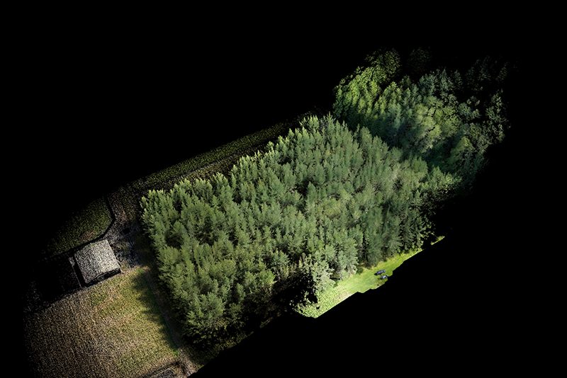
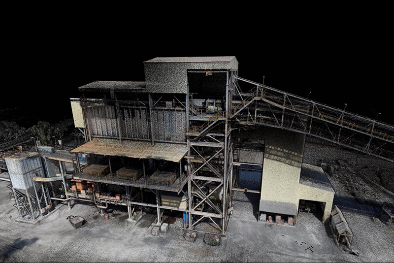
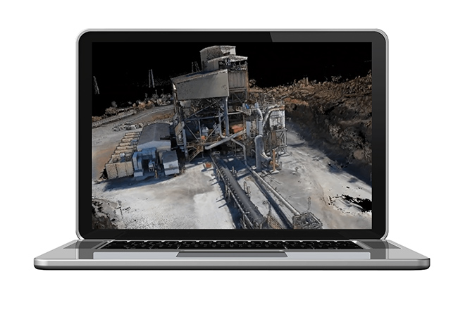
Add a new level of reality capture to your 3D point cloudsHovermap 의 색상화 기능을 도입하여 Point Cloud 스캔에서 추가적인 시각효과를 제공합니다. 이제 Hovermap의 3D Point Cloud를 실제 컬러로 확대하여 시각화 및 분석을 위한 추가 효과 를 제공 할 수 있습니다. COLOURISATION 은 다양한 어플리케이션에 대해 더 나은 시각효과를 제공하여 이전에 중요한 인프라에 숨겨진 세부 정보를 보여줍니다.
01

- A Versatile and Modular Approach-
- 맞춤형 퀵 릴리스 마운트를 사용하여 최신의 액션 카메라 (GoPro Hero8)을 Hovermap에 연결하기만 하면 됩니다. 이 모듈식 접근 방식은 Hovermap의 다양성과 유연성을 확장하여 필요에 따라 컬러 스캔을 할 수 있습니다.
- 움직이는 스캐너의 카메라와 LiDAR 데이터를 결합하는 것은 쉬운 일이 아닙니다. 카메라와 LiDAR 센서 간의 정확한 보정 및 동기화를 달성하기 위해 경력한 소프트웨어 알고리즘을 개발하여 간단하고 사용하기 쉽게 유지하면서 놀라운 결과를 만들었습니다.
02

- Easy Processing-
- 스캔 및 데이터 처리는 간단합니다.
- Hovermap과 카메라는 버튼 하나만 누르면 시작되며, 캡처 후 LiDAR 및 비디오 데이터는 간단한 드래그 앤 드롭 워크 플로를 통해 처리됩니다. 숙련된 사용자의 경우 처리 및 출력 옵션을 추가로 조정하기 위해 광범위한 매개 변수를 사용할 수도 있습니다.
03

- Press Record and Start Scanning-
- Record를 누르고 컬러 포인트 클라우드 스캔을 시작하십시오.
- 카메라가 장착된 Hovermap을 드론에 장착하여 도달 할 수 없는 영역에 도달하거나, 휴대용 스캐너로 사용하십시오. 지원되는 드론에서 고급 SLAM 및 비행 자율성을 활용하여 GPS가 안되는 환경에서 컬러 스캔 비행을 더욱 활용 하십시오.
FIELD OF
APPLICATIONS
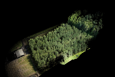
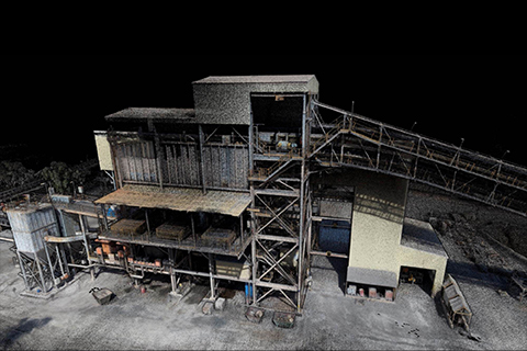
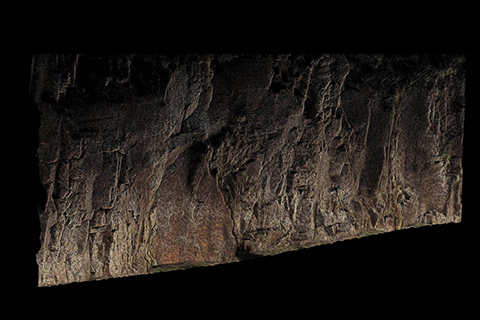
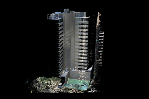
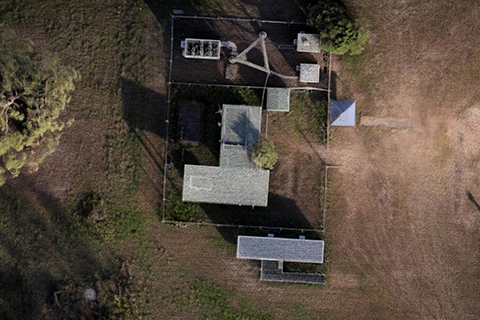
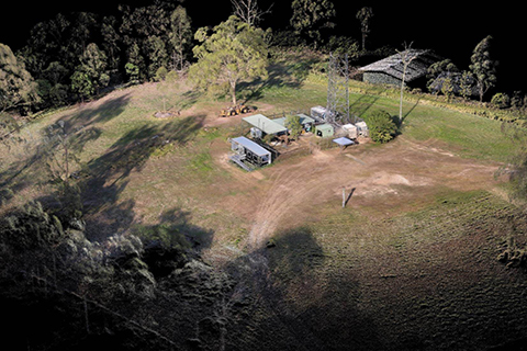
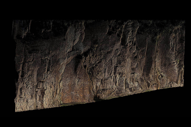
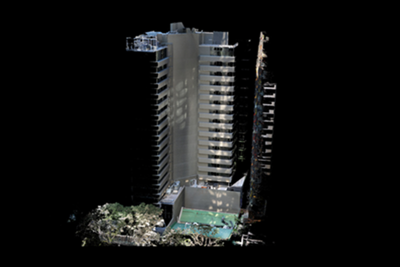
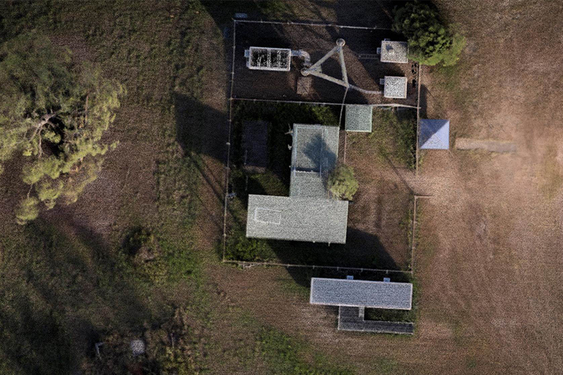
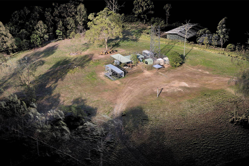
지하 갱도, 전력선, 통신타워 교량 검사-
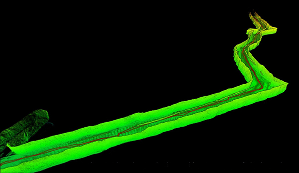
- 지하 광산의 매핑
-
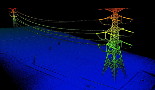
- 전력선 검사
-
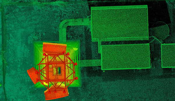
- 통신 타워 검사
-
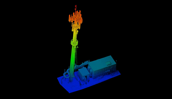
- 통신 타워 검사
-
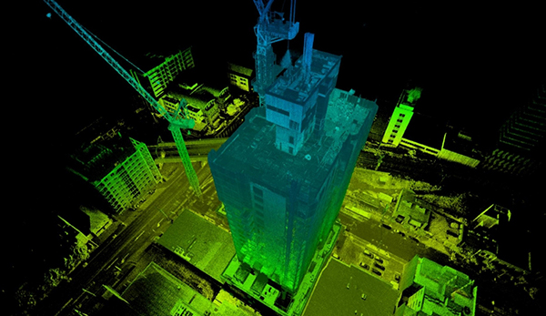
- 건설 모니터링
-
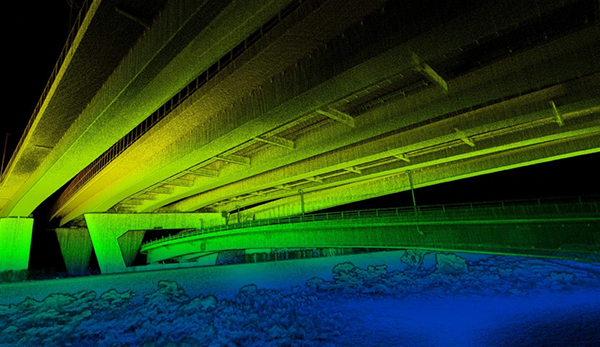
- 교량 검사
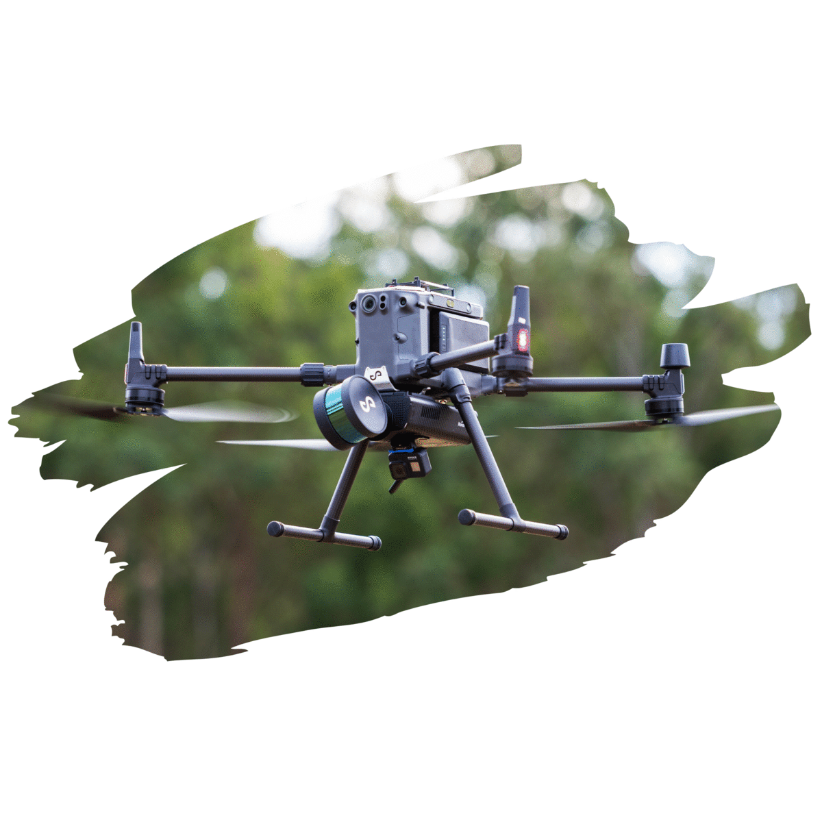
DRONE
HAND
DRONE
- 적용 분야
- 드론에 Hovermap을 장착해 높은 송전탑, 깊은 동굴을 매핑 할 수 있습니다.
- 주요 장점
- SLAM-based 3D mapping
- GPS-denied Flight
- Collision avoidance
- autonomy
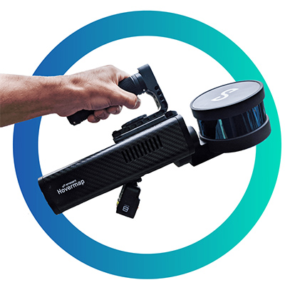
HAND
- 적용 분야
- 삼각대 , 사람이 직접 Hovermap을 들고 건물 내부를 매핑 할 수 있습니다.
- 주요 장점
- SLAM-based 3D mapping
- GPS-denied Flight
- Collision avoidance
- autonomy
Revolutionary autonomy for data gathering, analysis and insights in challenging and GPS denied environments.
SLAM (Simultaneous Localisation and Mapping)을 사용 하여
GPS를 사용할수 없는 경우에도 매핑이 가능합니다.
Hovermap
전방향 LiDAR 기반 회피 기능으로 안전한 매핑이 가능하며,SLAM (Simultaneous Localisation and Mapping)을 사용 하여
GPS를 사용할수 없는 경우에도 매핑이 가능합니다.
Hovermap
×
Benefits
- Unique two-in-one plus-and-play payload provides mapping and autonomy
- No GPS required for mapping
- Fast processing (2:1 process-to-capture time)
- Spherical Field of View - map and avoid collisions below, above and all around
- Suitable for night-time or low-light mapping
- Collision avoidance keeps drone safe while flying close to structures to inspect and map them
- CPS-denied flight allows flying indoors, underground or under bridges
Applications
- Asset management
- Infrastructure and building inspection
- Forensic crime scene mapping
- Underground mone mapping
- Construction site mapping
- Quarry mapping
- Power line mapping
Mapping Specifications
| Lidar range | Up to 100m |
|---|---|
| Lidar accuracy | +/- 3㎝ |
| Global SLAM accuracy | +/- 0.1% typical |
| Angular field of view | 360˚ × 360˚ |
| Data acquisition speed | 300,000 points/sec |
| File size | ~300MB/min |
| Flight speed | Up to 5m/s (scene dependant) |
| Laser safety class | Class 1 eye safe |
| Power | Max. 90W |
| Input voltage | 12 - 50V (e.g. 4s LiPo) |
| Weight | 2㎏ |
| Point cloud file farmat | .las, .ply |
Autonomy Specifications
| Flight Modes | Manual Pliot Assist |
|---|---|
| Autopilot Compatibility | DJI A3 |
| Collision Avoidance field of view | 360˚ × 360˚ |
| GPS-denied flight | Yes, within Line-of-Sight |